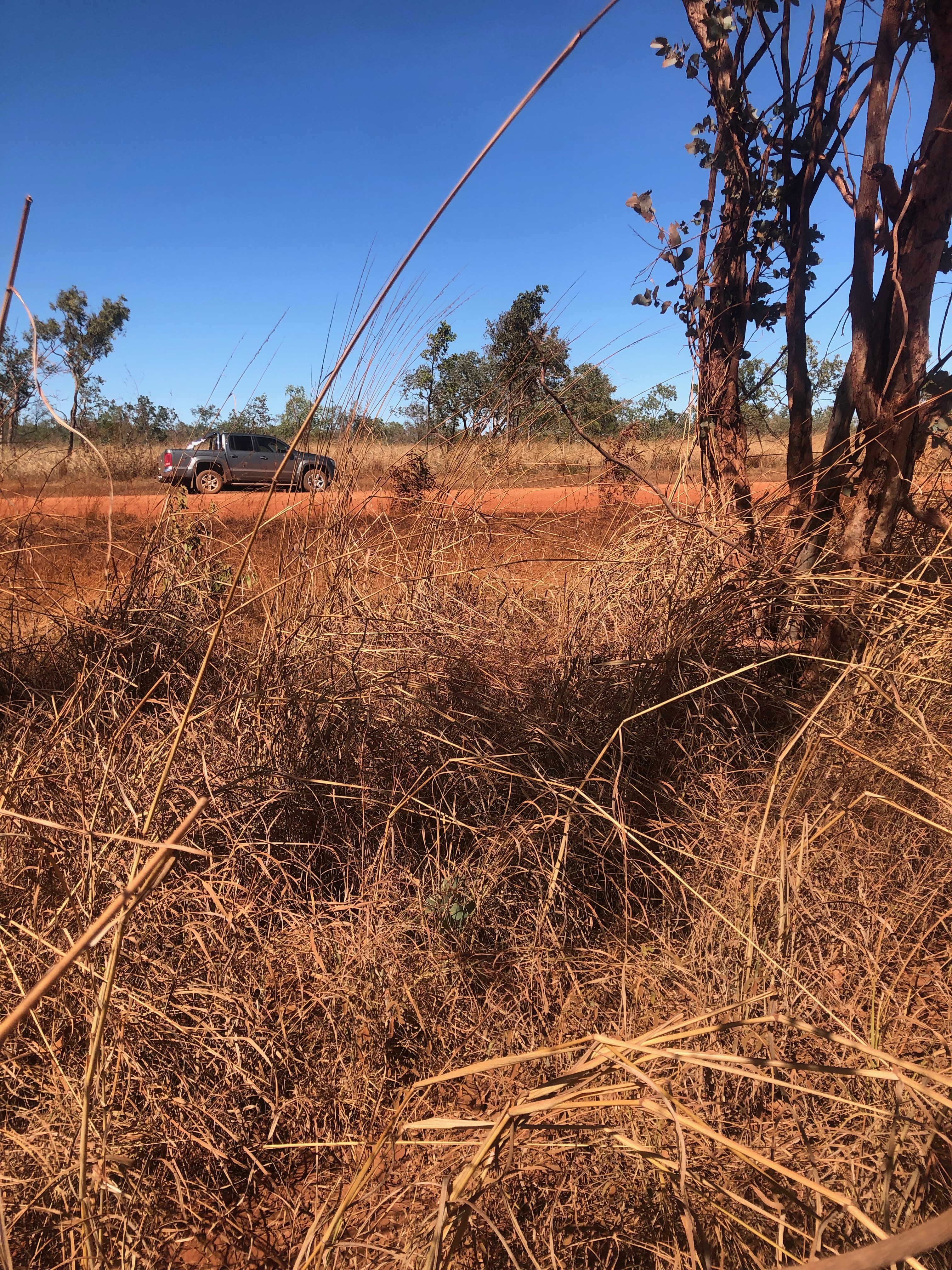
If you've spent any time on the Stuart Highway north of Mataranka in the last couple of months, you've probably passed some distinctive looking road trains carting iron ore towards Darwin. For the past six weeks, they have been steadily coming out of Northern Territory Iron Ore's mine which is part of something called the Roper Valley Iron Ore Project. What travellers on the Stuart Highway won't see is what those trucks are starting to do to country 150km east of the main highway.
I travel along this road - the Roper Highway - usually twice a week. The reddening of the area near the mine is noticeable. A week ago, I stopped to look at just how much dust was coating the roadside vegetation and the pics I tweeted caught the attention of ABC's Country Hour and the Environment Centre NT.
Took a closer look at what iron ore trucking is doing to this section of the Roper Highway. This is after trucks have only been running for six weeks. See sub-tweets for video @EnviroCentreNT pic.twitter.com/ScoiJwDTKN
— munanga linguist (@MunangaLinguist) July 4, 2022
You can hear me interviewed on NT Country Hour here (my bit starts at 06:00) and also see the resultant online article here.
With this activity, I ended up in touch with the EPA's pollution hotline. They recommended getting more evidence of dust pollution so that they may have cause to investigate themselves. So the bulk of this post is my first attempt at providing them with more evidence. (Note: anyone passing through this area, please collect your own evidence. Especially if you find red dust getting into waterways. Notify the NT EPA here - https://nt.gov.au/environment/environment-protection-recycling-waste/report-pollution)
"Control" Sample
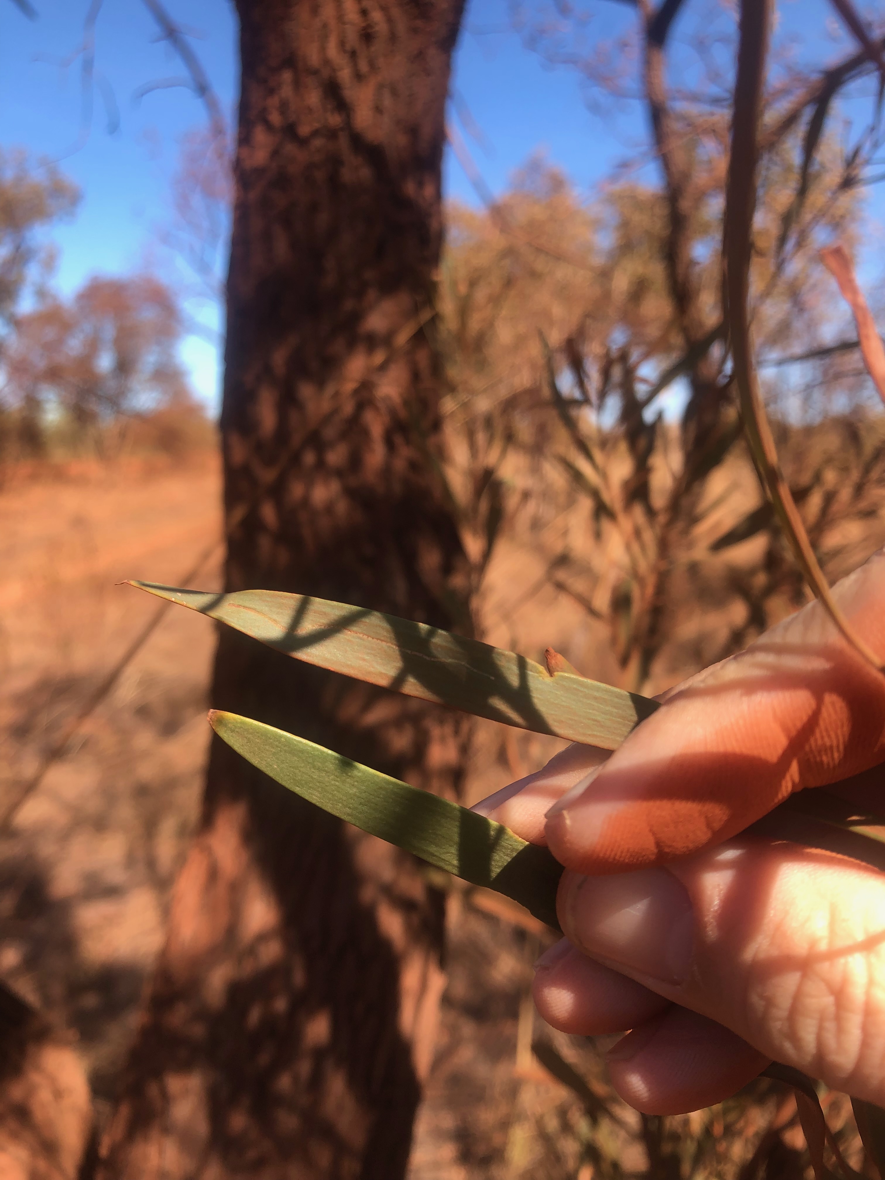
The first thing I did was some quick documentation at a site about 15km east of the mine turn-off (about 1km east of the Badawarrka turn-off). These images should show what dust impacts look like without the effects of iron-ore trucks going past: a "control" sample. Same road, same traffic minus the iron ore road trains. I also made sure I chose a section of country where the soil is quite red so that the dust would be noticeable on vegetation, like it is further down the highway.
 |
| Lat: 14° 42’ 7.398” S, Long: 134° 26’ 58.89” E |
Here's the dust on vegetation right on the verge of the road. You can see there is a light covering of dust on it:

I also made sure to check on impacts further in from the road, so I also walked a few metres (10m?) and checked for dust there. There, I couldn't really detect any dust:
"Proximal" Sample
The next evidence I got was very close to where iron ore road trains turn onto the Roper Highway. This is where any impacts of dust pollution caused by road trains should be most apparent.

 |
| Lat: 14° 43’ 35.862” S, Long: 134° 16’ 18.33” E |
A closer look and the dust covering plants on the verge is thick:

It wasn't particularly easy to reveal the green of the leaf underneath the dust:
An image showing the contrast after I (tried to) dust off a leaf:

I then repeated what I'd done at the 'control' site and walked several metres in from the verge. At the control site, I couldn't really detect dust on the leaves. Here, however, there was still obvious dust on vegetation though not the thick coating found on the verge:
The visible contrast after cleaning dust off a leaf (about 10m in from the road):
As a final sample from this site, I walked further off the road, perhaps a good 30-40m in.

There, leaves barely showed visible dust but you can notice traces:

"Distal" Sample
The third thing I did was to stop again another 5mins (about 8km?) down the road to see what the dust impacts look like at some distance from the mine site, where we can assume the road trains have less dust to disperse. (The GPS location for this site is: Latitude: 14° 44’ 56.358” S, Longitude: 134° 13’ 44.85” E).
Again, vegetation on the verge, had quick a thick covering of dust - certainly more than at the control site:


As with the other site, I also checked dust levels about 10m in from the verge:

Just the beginning
A reminder: this is just the beginning of this story. Firstly, the iron ore trucks have only been running for around six weeks. Secondly, the mine isn't even operational. The ore being transported is apparently only the stockpile left over from the failed previous operators of the mine, Sherwin Iron. Yet the dust pollution is already obvious.
If/when the mine does start operation, the volume of ore being transported will increase and over time the dust pollution will increase and its effects compound. The evidence I'm sharing here is really just a red flag of what is likely to come.
Other issues with the mine
While this post is specifically to document the start of dust pollution created by the NTIO operation, it is not the only issue I am aware of with this mine.
What does NTIO have approval for?
As you can hear in the interview I did with ABC, there was a point of confusion: the mine where this ore and trucks are coming from is (I learned after tweeting pics of the dust-coated plants) not yet through its environmental approval process. A staff member at the EPA told me "they shouldn't be doing anything", but then it seems the iron being transported at the moment is from a stockpile from the previous failed operators, Sherwin, and so approvals to move it relates to Sherwin's pre-existing approvals.
But those approvals are apparently with Department of Industry, Tourism and Trade (not with the EPA) and I'm not sure how to access them. Note that neither Sherwin's old operations or the present NTIO operations have a publicly available Mining Management Plan on the NT Government site: https://industry.nt.gov.au/publications/mining-and-energy/public-environmental-reports/mining/public-mining-environmental-reports/mines
No approval to recommence operations
NTIO doesn't have approval to restart operations. The advice I received from the EPA seems to say that not only does NTIO need to go through its own Environment Impact approval process, it sounds like they've been too slow and need to start again. That's my take anyway. This is what I was emailed:
The NT EPA required a new EIS to cover the new activities. The assessment process was started in 2017 but only limited steps were taken. The NT EPA is in consultation with the new owners of the mine about terminating the assessment process due to the amount of time that has lapsed since the process started. A new referral to the NT EPA would be required if the activities are proposed in future.
No communication in or benefit to Ngukurr
Traffic issues
 |
| "The single-lane Territory highway has been put under intense pressure by three mining projects" (NT News, 11/9/13) |
Who even owns the mine? (And how does anyone contact them?)
|
| Still trying to suss out if the mine operated by NTIO or Hoa Phat |
Comments
modular workstation noida
office chair in noida
cafeteria-furniture noida
metal storage system in noida
Shrink Packing machine Delhi
Shrink wrapping machine delhi
Box Wrapping machine delhi
Strapping machine in delhi
Pallet Rack delhi
Heavy Duty Rack Delhi